
In mid-2019 SLAM Education, in collaboration with the AustSTEM Foundation, organised an outdoor STEM day for around 80 indigenous students in Years 5 to 11 attending a STEM camp sponsored by the Aboriginal Education Consultative Group (NSW) .
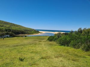 The STEM day was held at the Glenrock Scout Camp facilities near Newcastle where there is a large scout hall, amenities, and an abundance of natural bushland and lagoon foreshore to conduct bush science.
The students were divided into four groups and cycled through four activities:
- Two involving bush science using quadrats, transects and the Kookaberry technology platform loaned by the AustSTEM Foundation.
- One a demonstration of commercial drones by Uavair
- One creating 360 degree videos using equipment from the NSW Education T4L facility at Redfern
Bush Science Discovery: Quadrats and Transects
Each group of 20 was further divided into 5 groups of 4 students with a balanced mix of years 5 to 11 wherever possible. These five groups were provided with both paper and Kookaberry resources and carried out two environmental fieldwork activities as described below. As time was very limited, only the fieldwork measurements were carried out. Analysis of the results, together with a understanding of the measurement processes; the sensors involved; and the overall context of environmental fieldwork had to be left for another time.
Vegetation Survey: Quadrats
As the video shows, quadrats are used to determine the distribution of different types of vegetation over a large area by sampling just random bits of it.
The 500mm square quadrats used at Glenrock were made from PVC coated flower mesh bought from Bunnings. All the students were instructed on the vegetation types they would see, and the three most numerous, plus a rarer type, were given a colour corresponding to the four coloured buttons on the Kookaberry.
Two Kookaberries were allocated to each group. One was used as count accumulator of each of the vegetation types observed in a quadrant and the other was fitted with a temperature sensor (the DHT11) to measure the temperature at the testing site
Each group was then allocated an area where they measured the distribution of vegetation type and ambient temperature in each of at least five randomly scattered quadrats. The data were recorded on both paper and on the Kookaberry.
Microclimate Survey or Abiotic Field Study: Transects
As the video shows, a transect is used to determine the effect of abiotic factors (which are non-living things like soil moisture, temperature and light) on living organisms (plants, trees etc) at a distance from a geographic feature like a river or a road.
At Glenrock, each group was provided with a long rope with knots at 2 metre intervals, and two Kookaberries. One was fitted with a dual sensor (the DHT11) which measures both Temperature and Relative Humidity; and the other with a sensor which measures the Percentage Moisture in the soil. A paper table template was provided to record the data.
The transect rope for each group was laid up the slope from the river towards the scout hall and measurements of soil moisture, temperature, and relative humidity using the Kookaberry were made at 2m intervals. The measured data were recorded in the table together with observations of vegetation and tree and shrub cover.
As noted in the introduction, time did not allow more than the measurements to be made and the transect process understood. However, each group noted that the soil moisture decreased as the distance from the river increased.
Whilst this was an obvious result, one group noted that the moisture level actually increased some distance up the slope from the river. Further investigation of this apparent anomaly was unfortunately not possible, but would have probably been due to sub-soil moisture flowing downhill over solid rock and reaching the surface due to the soil cover being shallow at that point.
An additional Kookaberry fitted with a light sensor was used to measure the light level at each transect point.